Custom Ordnance Survey Explorer Map Wallpaper

Custom Explorer Map Wallpaper Centred on Your Location
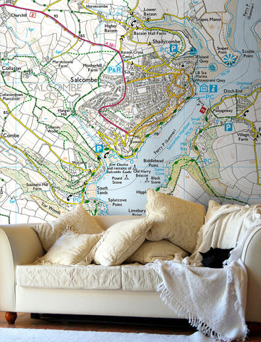
Bring the great outdoors inside with a made-to-measure OS Explorer map wallpaper, centred on any postcode in England, Scotland, or Wales. Using Ordnance Survey's iconic 1:25,000 Explorer mapping, every mural captures footpaths, contours, woodland, and open countryside in extraordinary detail. Get a Quote & Proof here.
Why Choose OS Explorer Map Wallpaper?
- Unrivalled countryside detail - footpaths, bridleways, contour lines, woodland, and open access land all shown
- Add Hillshading - three-dimensional relief shading brings hills, valleys, and terrain to life on your wall
- 1:25,000 scale - the gold standard for walkers, cyclists, and outdoor enthusiasts
- Centred on your postcode - your home, a favourite walk, a meaningful place
- Made to measure - printed to your exact wall dimensions
- A truly personal gift - ideal for walkers, fell runners, cyclists, and anyone with a special connection to a place
Bespoke Options for Business
Looking for something tailored to your organisation? We can customise your Explorer map wallpaper with your company logo, branded colours, and bespoke details. Perfect for outdoor activity centres, visitor attractions, estate offices, and hospitality venues. Contact us with your requirements and we'll create a map wallpaper built around you.


Share this item: